Wes and I decided to up our game with a bit of scrambling today, so we decided on the Mountaineer’s Route of Strawberry Peak. I had done this peak a few weeks earlier via the normal trail and thought it would be more fun to do the scramble.

This hike starts out at the Colby Canyon trailhead, following the canyon floor for about a half mile. After a few stream crossings, Wes and I started up switchbacks that ended at a large, concrete, water storage tank. This was Josephine Saddle.

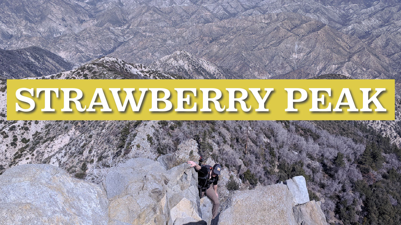
From this point, the Mountaineer’s Route is not obvious. There is no visible trail, so Wes and I bushwhacked our way straight up by faith until we found the trail that followed the backbone of the ridge.
In a quarter mile, maybe less, we came to the first class 3 rock section. We climbed to the top and did some mush bushwhacking until we got to the final class 3 section that leads to the summit.
Don’t touch the “Poodle Bushes” which are easy to spot because they are fuzzy. Touching these will give you a rash similar to poison oak, but not as severe. And there are a lot of them!
The last class 3 section looks really difficult from a distance, but once you start climbing it becomes quite easy. People have left red tape tied to branches to mark the route. There is no exposure. After 400 feet of climbing, Wes and I reached the summit.


We came down via the standard hiking trail that heads toward Mount Lawler. then back to the trailhead. Wes lamented that we should have descended the way we came up and saved an extra six miles of hiking. I think he was right, but it was a fun day nonetheless
Elevation Profile
